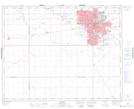
Maps showing Pense, 9-17-22-W2, Saskatchewan
Pense is a Village located in 9-17-22-W2, Saskatchewan and has an elevation of 569 meters.
- Latitude: 50° 24' 55'' North (decimal: 50.4152361)
- Longitude: 104° 59' 5'' West (decimal: -104.9847030)
- Topography Feature Category: Village
- Geographical Feature: Village
- Canadian Province/Territory: Saskatchewan
- Elevation: 569 meters
- Location: 9-17-22-W2
- Atlas of Canada Locator Map: Pense
- GPS Coordinate Locator Map: Pense Lat/Long