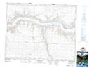
Maps showing Perrin Creek, 12-20-14-W3, Saskatchewan
Perrin Creek is a River located in 12-20-14-W3, Saskatchewan and has an elevation of 669 meters.
- Latitude: 50° 41' North (decimal: 50.6833711)
- Longitude: 107° 48' West (decimal: -107.8006747)
- Topography Feature Category: River
- Geographical Feature: Creek
- Canadian Province/Territory: Saskatchewan
- Elevation: 669 meters
- Location: 12-20-14-W3
- Atlas of Canada Locator Map: Perrin Creek
- GPS Coordinate Locator Map: Perrin Creek Lat/Long
Perrin Creek NTS Map Sheets