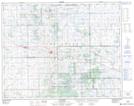
Maps showing Perry Lake, 2-29-16-W2, Saskatchewan
Perry Lake is a Lake located in 2-29-16-W2, Saskatchewan and has an elevation of 633 meters.
- Latitude: 51° 29' North (decimal: 51.4833639)
- Longitude: 104° 10' West (decimal: -104.1672047)
- Topography Feature Category: Lake
- Geographical Feature: Lake
- Canadian Province/Territory: Saskatchewan
- Elevation: 633 meters
- Location: 2-29-16-W2
- Atlas of Canada Locator Map: Perry Lake
- GPS Coordinate Locator Map: Perry Lake Lat/Long