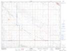
Maps showing Dummer, 30-10-21-W2, Saskatchewan
Dummer is a Unincorporated area located in 30-10-21-W2, Saskatchewan and has an elevation of 635 meters.
- Latitude: 49° 50' 37'' North (decimal: 49.8436456)
- Longitude: 104° 50' 15'' West (decimal: -104.8374994)
- Topography Feature Category: Unincorporated area
- Geographical Feature: Hamlet
- Canadian Province/Territory: Saskatchewan
- Elevation: 635 meters
- Location: 30-10-21-W2
- Atlas of Canada Locator Map: Dummer
- GPS Coordinate Locator Map: Dummer Lat/Long
Dummer NTS Map Sheets