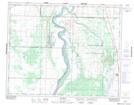
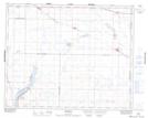
Maps showing Dundurn, 9-33-4-W3, Saskatchewan
Dundurn is a Town located in 9-33-4-W3, Saskatchewan and has an elevation of 534 meters.
- Latitude: 51° 48' 33'' North (decimal: 51.8092028)
- Longitude: 106° 30' 19'' West (decimal: -106.5053722)
- Topography Feature Category: Town
- Geographical Feature: Town
- Canadian Province/Territory: Saskatchewan
- Elevation: 534 meters
- Location: 9-33-4-W3
- Atlas of Canada Locator Map: Dundurn
- GPS Coordinate Locator Map: Dundurn Lat/Long
Dundurn NTS Map Sheets