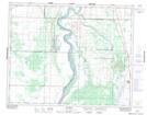
Maps showing Dundurn Creek, 33-4-W3, Saskatchewan
Dundurn Creek is a River located in 33-4-W3, Saskatchewan.
- Latitude: 51° 48' North (decimal: 51.8000393)
- Longitude: 106° 33' West (decimal: -106.5506152)
- Topography Feature Category: River
- Geographical Feature: Creek
- Canadian Province/Territory: Saskatchewan
- Location: 33-4-W3
- GPS Coordinate Locator Map: Dundurn Creek Lat/Long