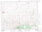
Maps showing Dyke Creek, 8-11-23-W3, Saskatchewan
Dyke Creek is a River located in 8-11-23-W3, Saskatchewan and has an elevation of 864 meters.
- Latitude: 49° 54' North (decimal: 49.9000338)
- Longitude: 109° 6' West (decimal: -109.1007358)
- Topography Feature Category: River
- Geographical Feature: Creek
- Canadian Province/Territory: Saskatchewan
- Elevation: 864 meters
- Location: 8-11-23-W3
- Atlas of Canada Locator Map: Dyke Creek
- GPS Coordinate Locator Map: Dyke Creek Lat/Long
Dyke Creek NTS Map Sheets