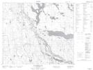
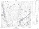
Maps showing East Trout Lake, 62-21-W2, Saskatchewan
East Trout Lake is a Lake located in 62-21-W2, Saskatchewan and has an elevation of 506 meters.
- Latitude: 54° 22' North (decimal: 54.3667215)
- Longitude: 105° 5' West (decimal: -105.0837841)
- Topography Feature Category: Lake
- Geographical Feature: Lake
- Canadian Province/Territory: Saskatchewan
- Elevation: 506 meters
- Location: 62-21-W2
- Atlas of Canada Locator Map: East Trout Lake
- GPS Coordinate Locator Map: East Trout Lake Lat/Long
East Trout Lake NTS Map Sheets