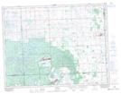
Maps showing East Two Island Lake, 3,4-10-4-W2, Saskatchewan
East Two Island Lake is a Lake located in 3,4-10-4-W2, Saskatchewan and has an elevation of 785 meters.
- Latitude: 49° 48' North (decimal: 49.8000130)
- Longitude: 102° 29' West (decimal: -102.4838287)
- Topography Feature Category: Lake
- Geographical Feature: Lake
- Canadian Province/Territory: Saskatchewan
- Elevation: 785 meters
- Location: 3,4-10-4-W2
- Atlas of Canada Locator Map: East Two Island Lake
- GPS Coordinate Locator Map: East Two Island Lake Lat/Long