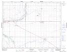
Maps showing Eastview, 18-17-24-W2, Saskatchewan
Eastview is a Unincorporated area located in 18-17-24-W2, Saskatchewan and has an elevation of 575 meters.
- Latitude: 50° 26' North (decimal: 50.4333639)
- Longitude: 105° 17' West (decimal: -105.2838979)
- Topography Feature Category: Unincorporated area
- Geographical Feature: Railway Point
- Canadian Province/Territory: Saskatchewan
- Elevation: 575 meters
- Location: 18-17-24-W2
- Atlas of Canada Locator Map: Eastview
- GPS Coordinate Locator Map: Eastview Lat/Long