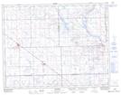
Maps showing Lost Horse Hill, 4-11-8-W2, Saskatchewan
Lost Horse Hill is a Mountain located in 4-11-8-W2, Saskatchewan and has an elevation of 639 meters.
- Latitude: 49° 53' North (decimal: 49.8833517)
- Longitude: 103° 3' West (decimal: -103.0505123)
- Topography Feature Category: Mountain
- Geographical Feature: Hill
- Canadian Province/Territory: Saskatchewan
- Elevation: 639 meters
- Location: 4-11-8-W2
- Atlas of Canada Locator Map: Lost Horse Hill
- GPS Coordinate Locator Map: Lost Horse Hill Lat/Long