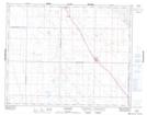
Maps showing Lovatt Lake, 19-27-1-W3, Saskatchewan
Lovatt Lake is a Lake located in 19-27-1-W3, Saskatchewan and has an elevation of 621 meters.
- Latitude: 51° 19' North (decimal: 51.3166974)
- Longitude: 106° 9' West (decimal: -106.1506019)
- Topography Feature Category: Lake
- Geographical Feature: Lake
- Canadian Province/Territory: Saskatchewan
- Elevation: 621 meters
- Location: 19-27-1-W3
- Atlas of Canada Locator Map: Lovatt Lake
- GPS Coordinate Locator Map: Lovatt Lake Lat/Long