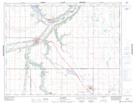
Maps showing Lumsden, 33-19-21-W2, Saskatchewan
Lumsden is a Town located in 33-19-21-W2, Saskatchewan and has an elevation of 511 meters.
- Latitude: 50° 38' 49'' North (decimal: 50.6470832)
- Longitude: 104° 52' 13'' West (decimal: -104.8703528)
- Topography Feature Category: Town
- Geographical Feature: Town
- Canadian Province/Territory: Saskatchewan
- Elevation: 511 meters
- Location: 33-19-21-W2
- Atlas of Canada Locator Map: Lumsden
- GPS Coordinate Locator Map: Lumsden Lat/Long