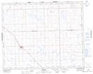
Maps showing Luseland, 8-36-24-W3, Saskatchewan
Luseland is a Town located in 8-36-24-W3, Saskatchewan and has an elevation of 702 meters.
- Latitude: 52° 4' 47'' North (decimal: 52.0796305)
- Longitude: 109° 23' 24'' West (decimal: -109.3898860)
- Topography Feature Category: Town
- Geographical Feature: Town
- Canadian Province/Territory: Saskatchewan
- Elevation: 702 meters
- Location: 8-36-24-W3
- Atlas of Canada Locator Map: Luseland
- GPS Coordinate Locator Map: Luseland Lat/Long
Luseland NTS Map Sheets