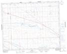
Maps showing Lydden Lake, 35-17-W3, Saskatchewan
Lydden Lake is a Lake located in 35-17-W3, Saskatchewan and has an elevation of 682 meters.
- Latitude: 52° 1' North (decimal: 52.0167196)
- Longitude: 108° 21' West (decimal: -108.3507000)
- Topography Feature Category: Lake
- Geographical Feature: Lake
- Canadian Province/Territory: Saskatchewan
- Elevation: 682 meters
- Location: 35-17-W3
- Atlas of Canada Locator Map: Lydden Lake
- GPS Coordinate Locator Map: Lydden Lake Lat/Long
Lydden Lake NTS Map Sheets