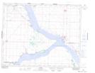
Maps showing Sage Bay, Saskatchewan
Sage Bay is a Bay located in Saskatchewan and has an elevation of 557 meters.
- Latitude: 51° 1' North (decimal: 51.0166964)
- Longitude: 106° 47' West (decimal: -106.7839640)
- Topography Feature Category: Bay
- Geographical Feature: Bay
- Canadian Province/Territory: Saskatchewan
- Elevation: 557 meters
- Atlas of Canada Locator Map: Sage Bay
- GPS Coordinate Locator Map: Sage Bay Lat/Long