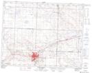
Maps showing St. Aldwyn, 17-13-W3, Saskatchewan
St. Aldwyn is a Unincorporated area located in 17-13-W3, Saskatchewan and has an elevation of 760 meters.
- Latitude: 50° 26' North (decimal: 50.4333672)
- Longitude: 107° 42' West (decimal: -107.7006685)
- Topography Feature Category: Unincorporated area
- Geographical Feature: Railway Point
- Canadian Province/Territory: Saskatchewan
- Elevation: 760 meters
- Location: 17-13-W3
- Atlas of Canada Locator Map: St. Aldwyn
- GPS Coordinate Locator Map: St. Aldwyn Lat/Long
St. Aldwyn NTS Map Sheets