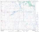
Maps showing Saint-Front, 24-39-16-W2, Saskatchewan
Saint-Front is a Unincorporated area located in 24-39-16-W2, Saskatchewan and has an elevation of 558 meters.
- Latitude: 52° 22' North (decimal: 52.3666714)
- Longitude: 104° 10' West (decimal: -104.1671693)
- Topography Feature Category: Unincorporated area
- Geographical Feature: Locality
- Canadian Province/Territory: Saskatchewan
- Elevation: 558 meters
- Location: 24-39-16-W2
- Atlas of Canada Locator Map: Saint-Front
- GPS Coordinate Locator Map: Saint-Front Lat/Long