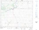
Maps showing St. Isidore-de-Bellevue, 44-27,28-W2, Saskatchewan
St. Isidore-de-Bellevue is a Hamlet located in 44-27,28-W2, Saskatchewan and has an elevation of 522 meters.
- Latitude: 52° 47' 2'' North (decimal: 52.7840250)
- Longitude: 105° 55' 8'' West (decimal: -105.9187543)
- Topography Feature Category: Hamlet
- Geographical Feature: Organized Hamlet
- Canadian Province/Territory: Saskatchewan
- Elevation: 522 meters
- Location: 44-27,28-W2
- Atlas of Canada Locator Map: St. Isidore-de-Bellevue
- GPS Coordinate Locator Map: St. Isidore-de-Bellevue Lat/Long