Maps showing St. Louis, 12-45-27-W2, Saskatchewan
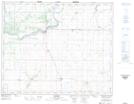
St. Louis is a Village located in 12-45-27-W2, Saskatchewan and has an elevation of 427 meters.
- Latitude: 52° 55' 16'' North (decimal: 52.9210111)
- Longitude: 105° 48' 40'' West (decimal: -105.8112388)
- Topography Feature Category: Village
- Geographical Feature: Village
- Canadian Province/Territory: Saskatchewan
- Elevation: 427 meters
- Location: 12-45-27-W2
- Atlas of Canada Locator Map: St. Louis
- GPS Coordinate Locator Map: St. Louis Lat/Long