Maps showing Salt Lake, 4-21-W2, Saskatchewan
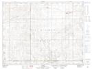
Salt Lake is a Lake located in 4-21-W2, Saskatchewan and has an elevation of 727 meters.
- Latitude: 49° 18' North (decimal: 49.3000319)
- Longitude: 104° 42' West (decimal: -104.7005325)
- Topography Feature Category: Lake
- Geographical Feature: Lake
- Canadian Province/Territory: Saskatchewan
- Elevation: 727 meters
- Location: 4-21-W2
- Atlas of Canada Locator Map: Salt Lake
- GPS Coordinate Locator Map: Salt Lake Lat/Long
Salt Lake NTS Map Sheets