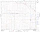
Maps showing Salvador, 9-37-25-W3, Saskatchewan
Salvador is a Unincorporated area located in 9-37-25-W3, Saskatchewan and has an elevation of 684 meters.
- Latitude: 52° 10' North (decimal: 52.1667339)
- Longitude: 109° 30' West (decimal: -109.5007535)
- Topography Feature Category: Unincorporated area
- Geographical Feature: Hamlet
- Canadian Province/Territory: Saskatchewan
- Elevation: 684 meters
- Location: 9-37-25-W3
- Atlas of Canada Locator Map: Salvador
- GPS Coordinate Locator Map: Salvador Lat/Long
Salvador NTS Map Sheets