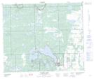
Maps showing Sanderson Bay, 58-23-W3, Saskatchewan
Sanderson Bay is a Bay located in 58-23-W3, Saskatchewan and has an elevation of 547 meters.
- Latitude: 54° 2' North (decimal: 54.0334323)
- Longitude: 109° 18' West (decimal: -109.3007546)
- Topography Feature Category: Bay
- Geographical Feature: Bay
- Canadian Province/Territory: Saskatchewan
- Elevation: 547 meters
- Location: 58-23-W3
- Atlas of Canada Locator Map: Sanderson Bay
- GPS Coordinate Locator Map: Sanderson Bay Lat/Long
Sanderson Bay NTS Map Sheets