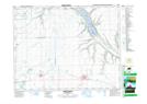
Maps showing Sandy Beach, 17-20-12-W2, Saskatchewan
Sandy Beach is a Village located in 17-20-12-W2, Saskatchewan and has an elevation of 481 meters.
- Latitude: 50° 44' North (decimal: 50.7333658)
- Longitude: 103° 39' West (decimal: -103.6505167)
- Topography Feature Category: Village
- Geographical Feature: Resort Village
- Canadian Province/Territory: Saskatchewan
- Elevation: 481 meters
- Location: 17-20-12-W2
- Atlas of Canada Locator Map: Sandy Beach
- GPS Coordinate Locator Map: Sandy Beach Lat/Long
Sandy Beach NTS Map Sheets