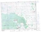
Maps showing Sandy Lake, 9,16-10-4-W2, Saskatchewan
Sandy Lake is a Lake located in 9,16-10-4-W2, Saskatchewan and has an elevation of 769 meters.
- Latitude: 49° 49' North (decimal: 49.8166794)
- Longitude: 102° 29' West (decimal: -102.4838298)
- Topography Feature Category: Lake
- Geographical Feature: Lake
- Canadian Province/Territory: Saskatchewan
- Elevation: 769 meters
- Location: 9,16-10-4-W2
- Atlas of Canada Locator Map: Sandy Lake
- GPS Coordinate Locator Map: Sandy Lake Lat/Long