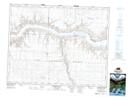
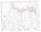
Maps showing Saskatchewan Landing Provincial Park, 19,20-14,15,16-W3, Saskatchewan
Saskatchewan Landing Provincial Park is a Conservation area located in 19,20-14,15,16-W3, Saskatchewan and has an elevation of 620 meters.
- Latitude: 50° 39' 58'' North (decimal: 50.6661514)
- Longitude: 107° 59' 23'' West (decimal: -107.9896635)
- Topography Feature Category: Conservation area
- Geographical Feature: Provincial Park
- Canadian Province/Territory: Saskatchewan
- Elevation: 620 meters
- Location: 19,20-14,15,16-W3
- Atlas of Canada Locator Map: Saskatchewan Landing Provincial Park
- GPS Coordinate Locator Map: Saskatchewan Landing Provincial Park Lat/Long
Saskatchewan Landing Provincial Park NTS Map Sheets