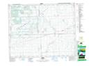
Maps showing Pheasant Forks, 22-21-9-W2, Saskatchewan
Pheasant Forks is a Unincorporated area located in 22-21-9-W2, Saskatchewan and has an elevation of 577 meters.
- Latitude: 50° 49' North (decimal: 50.8166813)
- Longitude: 103° 10' West (decimal: -103.1671756)
- Topography Feature Category: Unincorporated area
- Geographical Feature: Locality
- Canadian Province/Territory: Saskatchewan
- Elevation: 577 meters
- Location: 22-21-9-W2
- Atlas of Canada Locator Map: Pheasant Forks
- GPS Coordinate Locator Map: Pheasant Forks Lat/Long