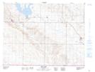
Maps showing Phillis Lake, 3-29-W2, Saskatchewan
Phillis Lake is a Lake located in 3-29-W2, Saskatchewan and has an elevation of 817 meters.
- Latitude: 49° 12' North (decimal: 49.2000279)
- Longitude: 105° 50' West (decimal: -105.8339027)
- Topography Feature Category: Lake
- Geographical Feature: Lake
- Canadian Province/Territory: Saskatchewan
- Elevation: 817 meters
- Location: 3-29-W2
- Atlas of Canada Locator Map: Phillis Lake
- GPS Coordinate Locator Map: Phillis Lake Lat/Long
Phillis Lake NTS Map Sheets