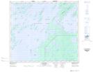
Maps showing Pike Island, Saskatchewan
Pike Island is a Island located in Saskatchewan and has an elevation of 354 meters.
- Latitude: 55° 3' North (decimal: 55.0500653)
- Longitude: 104° 59' West (decimal: -104.9837822)
- Topography Feature Category: Island
- Geographical Feature: Island
- Canadian Province/Territory: Saskatchewan
- Elevation: 354 meters
- Atlas of Canada Locator Map: Pike Island
- GPS Coordinate Locator Map: Pike Island Lat/Long
Pike Island NTS Map Sheets