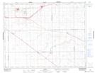
Maps showing Pilot Butte, 33-17-18-W2, Saskatchewan
Pilot Butte is a Town located in 33-17-18-W2, Saskatchewan and has an elevation of 612 meters.
- Latitude: 50° 28' 37'' North (decimal: 50.4770416)
- Longitude: 104° 25' 2'' West (decimal: -104.4173085)
- Topography Feature Category: Town
- Geographical Feature: Town
- Canadian Province/Territory: Saskatchewan
- Elevation: 612 meters
- Location: 33-17-18-W2
- Atlas of Canada Locator Map: Pilot Butte
- GPS Coordinate Locator Map: Pilot Butte Lat/Long