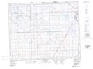
Maps showing Plain View, 33-24-7-W2, Saskatchewan
Plain View is a Unincorporated area located in 33-24-7-W2, Saskatchewan and has an elevation of 587 meters.
- Latitude: 51° 6' North (decimal: 51.1000029)
- Longitude: 102° 57' West (decimal: -102.9504963)
- Topography Feature Category: Unincorporated area
- Geographical Feature: Locality
- Canadian Province/Territory: Saskatchewan
- Elevation: 587 meters
- Location: 33-24-7-W2
- Atlas of Canada Locator Map: Plain View
- GPS Coordinate Locator Map: Plain View Lat/Long
Plain View NTS Map Sheets