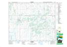
Maps showing Pleasantdale, 34-41-18-W2, Saskatchewan
Pleasantdale is a Village located in 34-41-18-W2, Saskatchewan and has an elevation of 533 meters.
- Latitude: 52° 34' 35'' North (decimal: 52.5764971)
- Longitude: 104° 30' 24'' West (decimal: -104.5066166)
- Topography Feature Category: Village
- Geographical Feature: Village
- Canadian Province/Territory: Saskatchewan
- Elevation: 533 meters
- Location: 34-41-18-W2
- Atlas of Canada Locator Map: Pleasantdale
- GPS Coordinate Locator Map: Pleasantdale Lat/Long