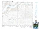
Maps showing Prairie View Lake, 18-11-W3, Saskatchewan
Prairie View Lake is a Lake located in 18-11-W3, Saskatchewan and has an elevation of 731 meters.
- Latitude: 50° 32' North (decimal: 50.5333664)
- Longitude: 107° 28' West (decimal: -107.4673257)
- Topography Feature Category: Lake
- Geographical Feature: Lake
- Canadian Province/Territory: Saskatchewan
- Elevation: 731 meters
- Location: 18-11-W3
- Atlas of Canada Locator Map: Prairie View Lake
- GPS Coordinate Locator Map: Prairie View Lake Lat/Long
Prairie View Lake NTS Map Sheets