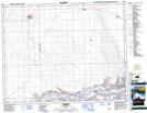
Maps showing Eatonia, 26-25-W3, Saskatchewan
Eatonia is a Town located in 26-25-W3, Saskatchewan and has an elevation of 723 meters.
- Latitude: 51° 13' 22'' North (decimal: 51.2229028)
- Longitude: 109° 23' 17'' West (decimal: -109.3880722)
- Topography Feature Category: Town
- Geographical Feature: Town
- Canadian Province/Territory: Saskatchewan
- Elevation: 723 meters
- Location: 26-25-W3
- Atlas of Canada Locator Map: Eatonia
- GPS Coordinate Locator Map: Eatonia Lat/Long