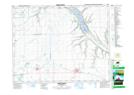
Maps showing Edgeley, 27-19-15-W2, Saskatchewan
Edgeley is a Hamlet located in 27-19-15-W2, Saskatchewan and has an elevation of 628 meters.
- Latitude: 50° 38' 18'' North (decimal: 50.6384138)
- Longitude: 103° 59' 46'' West (decimal: -103.9961889)
- Topography Feature Category: Hamlet
- Geographical Feature: Organized Hamlet
- Canadian Province/Territory: Saskatchewan
- Elevation: 628 meters
- Location: 27-19-15-W2
- Atlas of Canada Locator Map: Edgeley
- GPS Coordinate Locator Map: Edgeley Lat/Long
Edgeley NTS Map Sheets