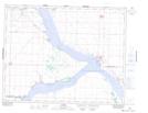
Maps showing The Elbow, 4-25-5-W3, Saskatchewan
The Elbow is a Cape located in 4-25-5-W3, Saskatchewan and has an elevation of 555 meters.
- Latitude: 51° 6' North (decimal: 51.1000312)
- Longitude: 106° 39' West (decimal: -106.6506281)
- Topography Feature Category: Cape
- Geographical Feature: Point
- Canadian Province/Territory: Saskatchewan
- Elevation: 555 meters
- Location: 4-25-5-W3
- Atlas of Canada Locator Map: The Elbow
- GPS Coordinate Locator Map: The Elbow Lat/Long