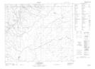
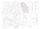
Maps showing Scarth River, 61-14-W2, Saskatchewan
Scarth River is a River located in 61-14-W2, Saskatchewan and has an elevation of 434 meters.
- Latitude: 54° 17' North (decimal: 54.2833952)
- Longitude: 104° 6' West (decimal: -104.1004214)
- Topography Feature Category: River
- Geographical Feature: River
- Canadian Province/Territory: Saskatchewan
- Elevation: 434 meters
- Location: 61-14-W2
- Atlas of Canada Locator Map: Scarth River
- GPS Coordinate Locator Map: Scarth River Lat/Long
Scarth River NTS Map Sheets