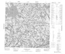
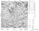
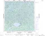
Maps showing Schurman Lakes, Saskatchewan
Schurman Lakes is a Lake located in Saskatchewan and has an elevation of 455 meters.
- Latitude: 59° 40' North (decimal: 59.6669478)
- Longitude: 106° 0' West (decimal: -106.0008376)
- Topography Feature Category: Lake
- Geographical Feature: Lakes
- Canadian Province/Territory: Saskatchewan
- Elevation: 455 meters
- Atlas of Canada Locator Map: Schurman Lakes
- GPS Coordinate Locator Map: Schurman Lakes Lat/Long
Schurman Lakes NTS Map Sheets