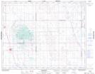
Maps showing Serath, 36-25-19-W2, Saskatchewan
Serath is a Unincorporated area located in 36-25-19-W2, Saskatchewan and has an elevation of 593 meters.
- Latitude: 51° 11' North (decimal: 51.1833731)
- Longitude: 104° 31' West (decimal: -104.5172241)
- Topography Feature Category: Unincorporated area
- Geographical Feature: Hamlet
- Canadian Province/Territory: Saskatchewan
- Elevation: 593 meters
- Location: 36-25-19-W2
- Atlas of Canada Locator Map: Serath
- GPS Coordinate Locator Map: Serath Lat/Long