Maps showing Shafer Creek, 33-6-29-W3, Saskatchewan
Shafer Creek is a River located in 33-6-29-W3, Saskatchewan and has an elevation of 1259 meters.
- Latitude: 49° 31' North (decimal: 49.5166951)
- Longitude: 109° 51' West (decimal: -109.8507596)
- Topography Feature Category: River
- Geographical Feature: Creek
- Canadian Province/Territory: Saskatchewan
- Elevation: 1259 meters
- Location: 33-6-29-W3
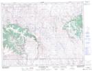
- Atlas of Canada Locator Map: Shafer Creek
- GPS Coordinate Locator Map: Shafer Creek Lat/Long
Shafer Creek NTS Map Sheets