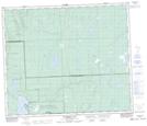
Maps showing Shallow Creek, 64-15-W3, Saskatchewan
Shallow Creek is a River located in 64-15-W3, Saskatchewan and has an elevation of 491 meters.
- Latitude: 54° 34' North (decimal: 54.5667539)
- Longitude: 108° 11' West (decimal: -108.1840389)
- Topography Feature Category: River
- Geographical Feature: Creek
- Canadian Province/Territory: Saskatchewan
- Elevation: 491 meters
- Location: 64-15-W3
- Atlas of Canada Locator Map: Shallow Creek
- GPS Coordinate Locator Map: Shallow Creek Lat/Long
Shallow Creek NTS Map Sheets