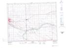
Maps showing Shand, 4-2-7-W2, Saskatchewan
Shand is a Unincorporated area located in 4-2-7-W2, Saskatchewan and has an elevation of 555 meters.
- Latitude: 49° 6' North (decimal: 49.1000351)
- Longitude: 102° 53' West (decimal: -102.8837884)
- Topography Feature Category: Unincorporated area
- Geographical Feature: Railway Point
- Canadian Province/Territory: Saskatchewan
- Elevation: 555 meters
- Location: 4-2-7-W2
- Atlas of Canada Locator Map: Shand
- GPS Coordinate Locator Map: Shand Lat/Long