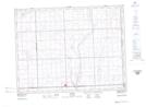
Maps showing Shepherd Ravine, 4,5-2,3-W2, Saskatchewan
Shepherd Ravine is a Valley located in 4,5-2,3-W2, Saskatchewan and has an elevation of 567 meters.
- Latitude: 49° 19' North (decimal: 49.3166897)
- Longitude: 102° 15' West (decimal: -102.2504533)
- Topography Feature Category: Valley
- Geographical Feature: Ravine
- Canadian Province/Territory: Saskatchewan
- Elevation: 567 meters
- Location: 4,5-2,3-W2
- Atlas of Canada Locator Map: Shepherd Ravine
- GPS Coordinate Locator Map: Shepherd Ravine Lat/Long