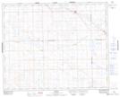
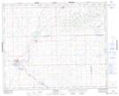
Maps showing Sheppard Sloughs, 37,38-26,27-W3, Saskatchewan
Sheppard Sloughs is a Lake located in 37,38-26,27-W3, Saskatchewan and has an elevation of 704 meters.
- Latitude: 52° 14' North (decimal: 52.2334020)
- Longitude: 109° 43' West (decimal: -109.7174292)
- Topography Feature Category: Lake
- Geographical Feature: Sloughs
- Canadian Province/Territory: Saskatchewan
- Elevation: 704 meters
- Location: 37,38-26,27-W3
- Atlas of Canada Locator Map: Sheppard Sloughs
- GPS Coordinate Locator Map: Sheppard Sloughs Lat/Long
Sheppard Sloughs NTS Map Sheets