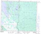
Maps showing Shoeman Lake, 55-5-W3, Saskatchewan
Shoeman Lake is a Lake located in 55-5-W3, Saskatchewan and has an elevation of 506 meters.
- Latitude: 53° 46' North (decimal: 53.7667202)
- Longitude: 106° 44' West (decimal: -106.7338815)
- Topography Feature Category: Lake
- Geographical Feature: Lake
- Canadian Province/Territory: Saskatchewan
- Elevation: 506 meters
- Location: 55-5-W3
- Atlas of Canada Locator Map: Shoeman Lake
- GPS Coordinate Locator Map: Shoeman Lake Lat/Long