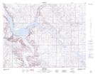
Maps showing Shookan Coulee, 2-22-W2, Saskatchewan
Shookan Coulee is a Valley located in 2-22-W2, Saskatchewan and has an elevation of 703 meters.
- Latitude: 49° 6' North (decimal: 49.1000296)
- Longitude: 104° 53' West (decimal: -104.8838637)
- Topography Feature Category: Valley
- Geographical Feature: Coulee
- Canadian Province/Territory: Saskatchewan
- Elevation: 703 meters
- Location: 2-22-W2
- Atlas of Canada Locator Map: Shookan Coulee
- GPS Coordinate Locator Map: Shookan Coulee Lat/Long
Shookan Coulee NTS Map Sheets