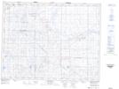
Maps showing Shooter Hill, 24-20-7-W3, Saskatchewan
Shooter Hill is a Unincorporated area located in 24-20-7-W3, Saskatchewan and has an elevation of 733 meters.
- Latitude: 50° 43' North (decimal: 50.7166972)
- Longitude: 106° 51' West (decimal: -106.8506315)
- Topography Feature Category: Unincorporated area
- Geographical Feature: Locality
- Canadian Province/Territory: Saskatchewan
- Elevation: 733 meters
- Location: 24-20-7-W3
- Atlas of Canada Locator Map: Shooter Hill
- GPS Coordinate Locator Map: Shooter Hill Lat/Long
Shooter Hill NTS Map Sheets