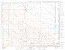
Maps showing Radville, 12-6-18-W2, Saskatchewan
Radville is a Town located in 12-6-18-W2, Saskatchewan and has an elevation of 637 meters.
- Latitude: 49° 27' 40'' North (decimal: 49.4609860)
- Longitude: 104° 17' 50'' West (decimal: -104.2973611)
- Topography Feature Category: Town
- Geographical Feature: Town
- Canadian Province/Territory: Saskatchewan
- Elevation: 637 meters
- Location: 12-6-18-W2
- Atlas of Canada Locator Map: Radville
- GPS Coordinate Locator Map: Radville Lat/Long
Radville NTS Map Sheets