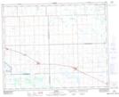
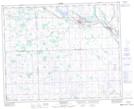
Maps showing Rama, 19-32-7-W2, Saskatchewan
Rama is a Village located in 19-32-7-W2, Saskatchewan and has an elevation of 556 meters.
- Latitude: 51° 45' 28'' North (decimal: 51.7577166)
- Longitude: 103° 0' 3'' West (decimal: -103.0009305)
- Topography Feature Category: Village
- Geographical Feature: Village
- Canadian Province/Territory: Saskatchewan
- Elevation: 556 meters
- Location: 19-32-7-W2
- Atlas of Canada Locator Map: Rama
- GPS Coordinate Locator Map: Rama Lat/Long
Rama NTS Map Sheets