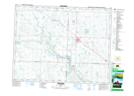
Maps showing Red Jacket, 21-14-32-W, Saskatchewan
Red Jacket is a Unincorporated area located in 21-14-32-W, Saskatchewan and has an elevation of 580 meters.
- Latitude: 50° 12' North (decimal: 50.2000072)
- Longitude: 101° 47' West (decimal: -101.7838160)
- Topography Feature Category: Unincorporated area
- Geographical Feature: Hamlet
- Canadian Province/Territory: Saskatchewan
- Elevation: 580 meters
- Location: 21-14-32-W
- Atlas of Canada Locator Map: Red Jacket
- GPS Coordinate Locator Map: Red Jacket Lat/Long
Red Jacket NTS Map Sheets